
The Rapid Update Cycle (RUC)

1 hr precipitation / MSLP / Thickness
Aviation Flight Rules
2m Potential Temperature / 10m Winds
- Modified 1 May 2012: The RUC was a NOAA/ NCEP
operational weather prediction system running every hour out to at least 18h
comprised primarily of
- A numerical forecast model (using isentropic-sigma hybrid vertical coordinate) and
- An analysis/assimilation system to initialize that model.
- Developed to serve users needing frequently updated short-range weather forecasts, including those in the US aviation community and US severe weather forecasting community.
- The Rapid Refresh (RAP) is the next-generation version of the 1-h cycle system, and replaced the operational RUC at NCEP at 12z on 1 May 2012.
News items
- 8 May 2012 - An experimental version of the RUC continues to run at ESRL for an undetermined period of time for baseline comparisons with the RAP (continued into 2016). 1 May 2012 RAP operational implementation at NCEP occurred at 12z on 1 May 2012 as planned. The last NCEP RUC run was 11z today.
- 2 March 2010 - RUC upgrade (although not completely installed until 20 April 2010. Explanation ): Extension of RUC to 18h every hour, modification to hybrid coordinate, addition of Canadian aircraft observations. More info available at https://www.nws.noaa.gov/om/notification/tin10-07aaa_ruc_changes.txt
- 4 Dec 2009 Problem with radar reflectivity ingest into NCEP-operational RUC starting early August, script updated to changed directory Tues 1 Dec.
- 12 Nov 2009 Rapid Refresh/RUC review presentation - latest news - PDF
- 14 Oct 2009 TAMDAR moisture observations restored to RUC (and NAM) for NCEP runs today after 50-day absence due to upstream metadata change. TAMDAR moisture observations have been available all along for all ESRL/GSD RUC runs.
- 31 Mar 2009. NCEP implementation at 12z with improved snow cover and improved cloud analysis, see Info PDF here. -
- 16 Dec 2008. TAMDAR data added to operational RUC at NCEP
- 17 Nov 2008. RUC upgrade implementation at NCEP Assimilation of radar reflectivity added, longwave radiation changed to RRTM scheme, convection (Grell-Devenyi) changes. Extended RUC upgrade ppt here for pre-implementation briefing
- 8 Jan 2008. RUC crisis change for improved cloud/vis assimilation, wind gust, precip type. , PDF
- 11 Dec 2007. RUC/RR summary Powerpoint/pdf presented at NCEP Production Suite Review meeting.
- 4 Dec 2007. 13km/hourly RUC grids became available via NOAAPort and Family of Services.
- Reflectivity real-time products available for devRUC13 and backup RUC13 uns since April 2007.
- 4 April 07 - 3-d radar reflectivity data assimilated hourly in experimental devRUC13 since Feb07 and now in backup RUC13 as now. An example of the effect of radar reflectivity assimilation in available here
- 28 June 2005 --
13km RUC operational implementation at NCEP --
-- Higher resolution, additional observation types assimilated (GPS PW, METAR cloud/vis, RASS, improved use of GOES cloud-top), improved moisture analysis, improved cloud/precip physics. -
RUC journal articles available in Feb 2004 Monthly Weather Review.
Mesoscale Weather Prediction with the RUC Hybrid Isentropic Terrain-Following Coordinate Model. pages 473-494. [GSD PDF version]
An Hourly Assimilation-Forecast Cycle: The RUC. pages 495-518. [GSD PDF version]
- high-frequency (every 1h) short-range weather model forecasts (out to 12+ h) in support of aviation and other mesoscale weather forecast users
-
high-frequency (every 1h) 3-d objective analyses
over much of North America,
including the contiguous United States and
adjacent areas of Canada and Mexico, assimilating the following types of observations:
- Commercial aircraft, including regional aircraft data with moisture (TAMDAR)
- Radar reflectivity (3-d)
- Profiler related
- Wind profilers (404 and boundary-layer 915 MHz)
- VAD (velocity-azimuth display) winds from NWS WSR-88D radars
- RASS (Radio Acoustic Sounding System)
- Rawinsondes and special dropwinsondes
- Surface
- Surface reporting stations and buoys (including cloud, visibility, current weather)
- Mesonet
- Satellite
- GPS total precipitable water estimates
- GOES cloud-top data (pressure and temperature)
- GOES total precipitable water estimates
- SSM/I total precipitable water estimates
- GOES high-density visible and IR cloud drift winds
- Experimental
- Lightning - experimental
- NASA Langley cloud products including water/ice path
- a hybrid isentropic-sigma vertical coordinate.
The key features of the RUC include:
Other RUC Information, Real-Time and Archived Data
Archived RUC gridded data available from:
- Background on RUC data from DOE/ARM Program DOE/ARM web page on RUC gridded data (link corrected 7-22-2011)
- NOMADS/NCEP/NOAA
- NCAR/UCAR - Access to archived GSD/FSL RUC/MAPS data for UCAR registered users (use search for 'MAPS')
Information on gridded data
- RUC grid files - Information on contents
-
RUC13 GRIB table-updated 17 Nov 2008
with RUC upgrade
(see RUC20 table for GRIB document links) - Previous RUC13 GRIB table as of Sept 2005
- RUC20 GRIB table with GRIB document links
- RUC analysis obs and background error specifications
Model fixed fields - topography, etc.
-
Download RUC fixed fields (ASCII) and software
- 13km topography, mini-topography, lat/lon, land-use, roughness length, soil type
- 5km RTMA topography (used for RUC-RTMA downscaling)
- 20-km, 40-km and 60-km topography or latitude/longitude
- 20km land-use, look-up table for roughness length, albedo, emissivity
- software to convert from RUC native coordinates/variables to isobaric coordinates/variables
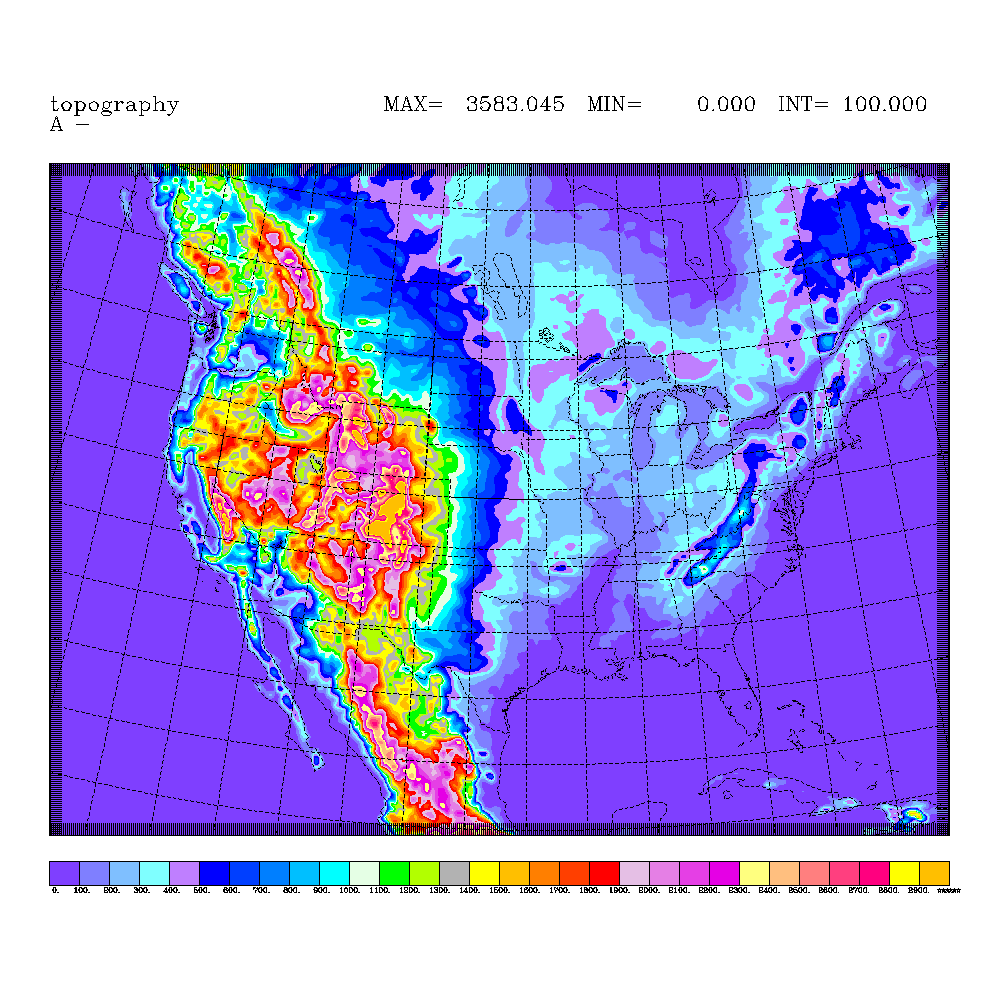
- 13-km RUC terrain elevation map
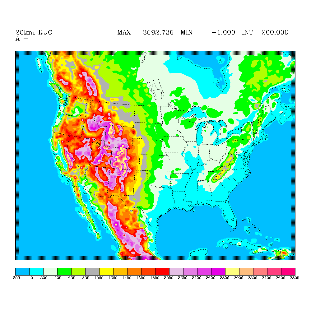
- 20-km RUC (pre June05) topography map
- NCEP daily sea-surface temperature file currently used in RUC
- Lightning coverage - Env Canada